Sustainability
A forward-thinking approach
The proposals have been developed with a focus on responding to climate change, managing water carefully, and supporting wildlife and creating places for people to live, underpinned by our Sustainability Strategy.
The outline planning application is supported by a range of technical assessments, which consider the environmental effects of the development and how these can be avoided, reduced or managed.
Green space & biodiversity
Supporting both community and local wildlife
Extensive environmental surveys have been carried out across the site to inform the proposals, including ecological assessments and protected species surveys such as bat surveys. These have not identified any fundamental constraints, and the scheme has been designed to protect and enhance existing habitats.
The plans include:
- Retention and strengthening of existing landscape features, including trees and hedgerows
- Delivery of new areas of public open space, including play areas for a range of age groups
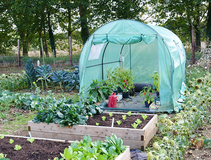
- New allotments and opportunities for community growing
- Creation of species-rich grassland and new tree and hedgerow planting
- Enhancements to existing Public Rights of Way, including widening to create a stronger green corridor
- Sustainable drainage features integrated within green spaces to support biodiversity and manage surface water
- A landscape-led approach to deliver a measurable biodiversity net gain

Travel
Access, walking and cycling
The site will be accessed from Deeping Road (A15) and Greatford Road, with both access points designed to ensure safe and convenient movement for all users.
A Transport Assessment has been submitted as part of the planning application, which considers the impact of the development and identifies opportunities to improve access and connectivity.
The proposals include a range of improvements to support walking and cycling, including new and enhanced routes through the site and better connections into Baston village.
This includes enhancements to the existing pedestrian crossing on the A15 (Deeping Road) and a new crossing on Main Street (near School Lane), helping to provide safer access to local facilities, including the primary school.
These measures are designed to encourage sustainable travel choices and make it easier for residents to walk and cycle for everyday journeys.
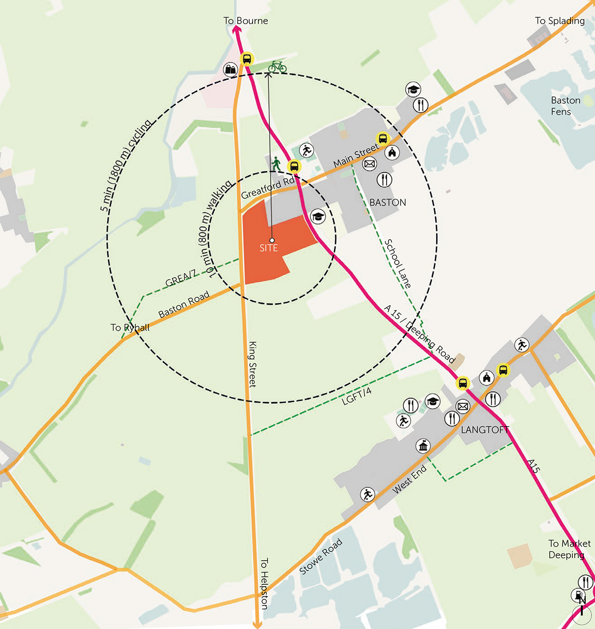
 Site boundary
 Primary road
 Secondary roads
 PRoW
PRoW Bus stop
 10 min walking
 5 min cycling
 Post Office
 Supermarket
 Restaurant
 Play field
 School
 Church
 Community hall
Managing water
Sustainable drainage system
Careful management of water and drainage is an important part of the proposals. Technical assessments have been carried out to understand how surface water can be managed in a controlled and sustainable way across the site.
The scheme will incorporate a sustainable drainage system (SuDS), designed to manage rainfall close to where it falls. This will include features such as swales and basins, which will slow the flow of water, reduce flood risk and improve water quality.
These features will be integrated within the landscape, providing both functional drainage and wider environmental benefits, including new habitats for wildlife.
The drainage strategy has been developed in consultation with Lincolnshire County Council (as Lead Local Flood Authority) and the Welland and Deeping Internal Drainage Board.
Flood risk assessment
The Environment Agency (EA) Flood Maps
Environment Agency Flood Maps show that the site is located within Flood Zone 1, which is at the lowest risk of flooding.
A Flood Risk Assessment has been submitted as part of the planning application, which confirms that the development can be delivered safely without increasing flood risk elsewhere.
The proposals have been designed alongside a sustainable drainage strategy to manage surface water effectively and ensure that runoff from the site is controlled.
 Redline boundary
 High (> 3.3% AEP)
 Medium (1.0% – 3.3% AEP)
 Low (0.1% – 1.0% AEP)